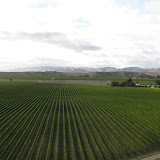
Setting: We were on an intensive cropping farm (mainly grasses for seed) in Ashburton. The farmer uses variable rate irrigators, and is known in Canterbury as an innovator and leader in responsible water usage.
The Project: Electromagnetic (EM) mapping had been done on a number of fields on the property. The map data was acquired by dragging an EM device behind a four-wheeler as it drives back and forth across the entire field. The map had been made a few months before our arrival, so we had no role in the actual collecting of EM data.
EM measures the conductivity of the soil, so it is thought to be a proxy of total water holding capacity (WHC). Our job was to select certain sites in which to dig soil pits, describe those soils, and sample them for further work back in the lab. With the samples (lab work we will do in the coming weeks), we are to determine the Available Water capacity (AWC) and see if that correlates with EM as well. AWC is different from WHC in that it only measures the water that plants can access. Some water is held too tightly in the soil by clays and micropores, creating negative pressure (suction) on that water which plants roots cannot overcome.
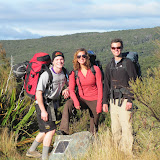
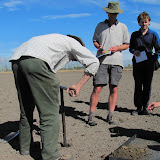
What we did: The first two days were spent augering in various areas, some at random spots and some along determined transects. By doing this, we could get a rough estimate of the soil patterns in the area, and make early comparisons of EM data to things like soil type, texture, and depth to gravels. Two members from the government research institute LandCare were working with us, and it was great to learn field techniques from the experts. Using what we learned from the augering, we could determine where we wanted to dig soil pits.
The last two days were spent digging full soil pits. We split up into groups and got a lot of digging done. The ground was really hard in some places and required some heavy pick work. All pits were about 80-90cm deep on average, and probably about a square meter horizontally. Digging a good pit is an art, and requires the building of steps, a lot of cleaning up of surfaces, and careful calculation of the sun's movement in the sky; You needed to dig your pit so that when you finished it and were ready to desribe/photograph it, the sun would be directly facing the description face, eliminating any shadow. To do that well, you had to accurately guess how long it would take you to dig the pit.
Doing a pit description takes just as long as digging the actual pit. You have to categorize the horizons, note their depth, and then do tests for color, texture, strength, and structure. After that, undisturbed samples had to be taken in little metal cores from each horizon, which is a lot more labor-intensive than you think. By the end of the trip, our class had dug, fully described, and sampled 7 full pits. It was a lot of work, and a lot of good experience.
What Now?: Our whole class is going to be processing this data into a single group project. So, for the next month we will have very few lectures and be concentrating mainly on research, labwork, data analysis, and mapping for this project. I've never done a group project where the whole class is the only group. I think it will prove to be great experience for my studies in the future, especially next year's thesis.
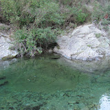
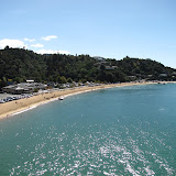
Here are some pictures: I would have liked to take more, but we were pretty busy the whole time and I often had wet soil on my hands.
 |
| Soil Resources Tour |